Hammerpot Area
North of present day A27
and south of Angmering Park
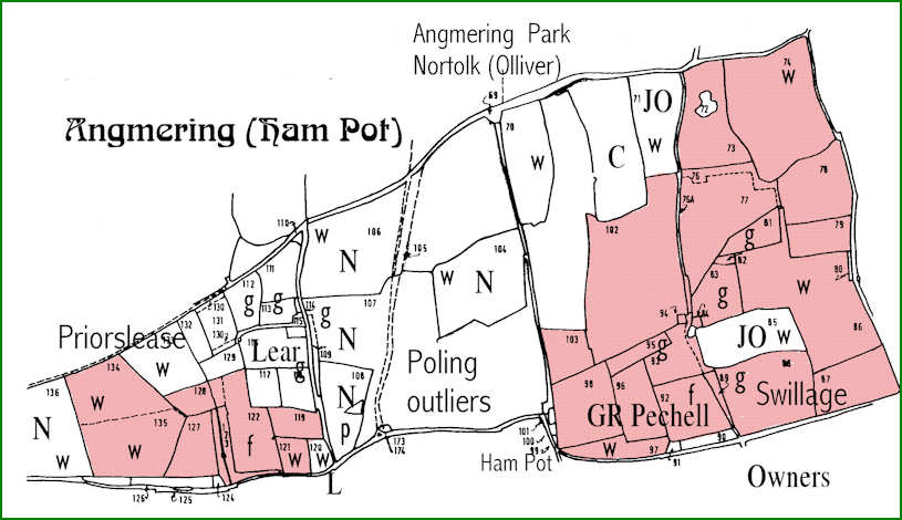
Legend
Owners and tenants as named
N Norfolk Duke of
JO James Olliver
C Corney [East Preston]
(Part 2, Chapter 9, Section 3) ( Bk. Index )
These Key Maps are for the central area of Angmering, south of Angmering Park, and excluding Ham Manor.
Individual Farm Maps can be located in relation to each, on maps which cover four large areas from Hammerpot south to the Worthing Road.
General Legend
f furze
g grass
p ponds
w woods
MAP 1
Hammerpot Area
North of present day A27
and south of Angmering ParkLegend
Owners and tenants as named
N Norfolk Duke of
JO James Olliver
C Corney [East Preston]
MAP 2
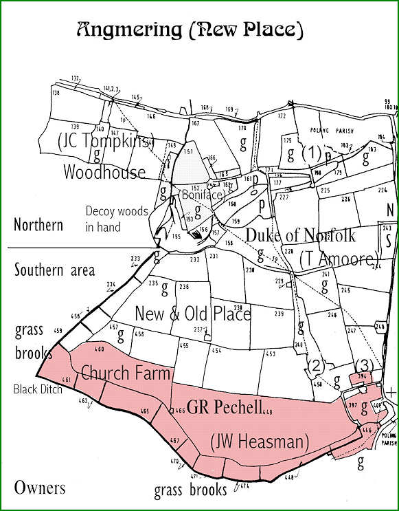
New Place and Old Place Area
North of Ham Manor
and south of A27
Legend
Owners and tenants as named
MAP 3
Avenals Area
North of Ecclesden Manor
and south of A27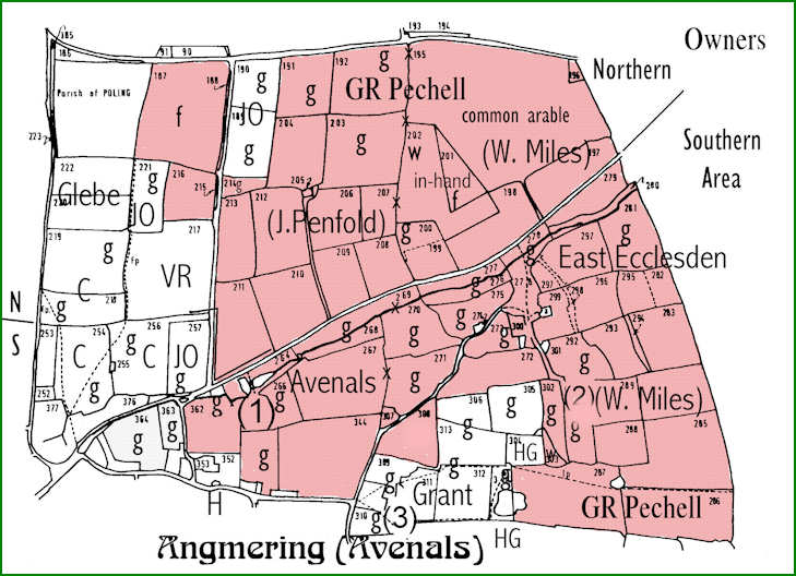
Legend
Owners and tenants as named
C George Cortis
JO James Olliver
VR Vicar of Rustington
MAP 4
Angmering and Ecclesden
North of coastal parishes
and south of Angmering High Street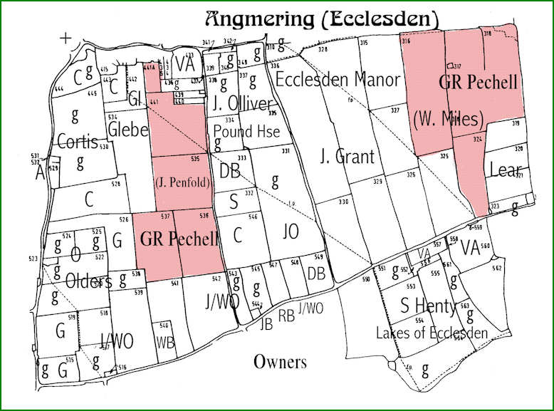
Legend
Owners and tenants as named
C Cortis
DB D. Boyce
G WGK Gratwicke
VA Vicar of Amberley
J/WO Olliver family
RWS 22/3/2009
Introduction to Tithes & Commutations
Bargham & Ham Apportionments
Angmering Apportionments